Survey

(415) 566-0133

Survey

(415) 566-0133

Hydrographic Surveys

Hydrographic SurveysHydrographic SurveysHydrographic Surveys

Multi-beam, Single-beam, Sidescan

Hydrographic Surveys

Hydrographic SurveysHydrographic SurveysHydrographic Surveys

Multi-beam, Single-beam, Sidescan

About Us

Multibeam survey

PCH Survey, LLC

  Multibeam survey of Seaplane lagoon in Alameda, CA


PCH Survey, LLC is a hydrographic survey company specializing in the acquisition and analysis of bathymetric data and side-scan imagery using the latest in sonar technology (multibeam, singlebeam, side scan) and software development.  Our field to finish approach focuses on efficiency with acquisition, data analysis, and final products which include high resolution bathymetric maps, volume calculations, cross-section reports, and sounding and contour maps.  PCH Survey, LLC is a fully vetted and certified Local Business Enterprise (LBE) with the City and County of San Francisco, California

  • Our biologists are also certified by NOAA to identify Caulerpa taxifolia and with CDFW to identify Pacific Herring.

Post dredge multibeam survey

Tiburon, CA


Tiburon Peninsula

Private residential


  • PCH Survey performed both the pre and post dredge hydrographic survey for residents living in Tiburon, CA

Post dredge multibeam survey

San Francisco, CA


Port of San Francisco

Mission Bay Ferry Terminal

  • PCH Survey performed both the pre an post dredge survey as a third party survey for The Dutra Group.

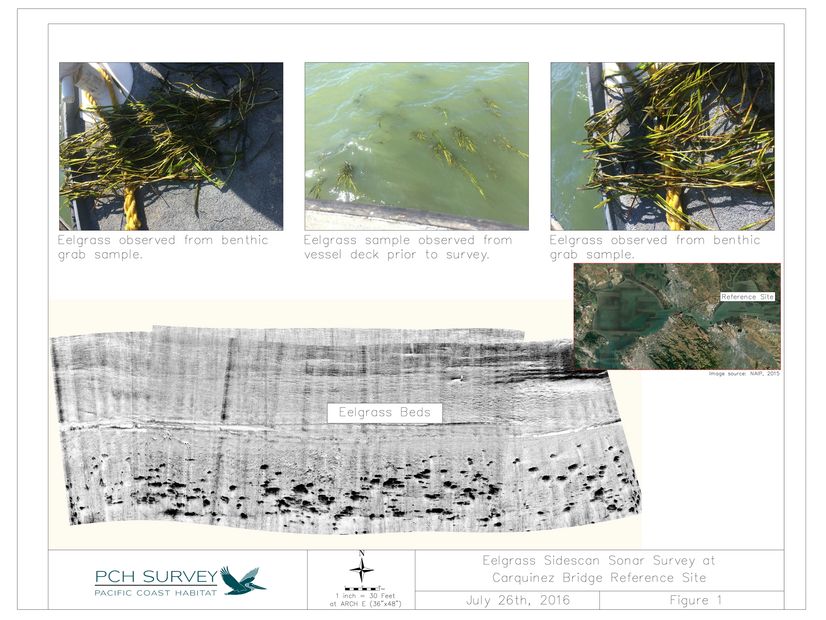
Eelgrass

Eelgrass Surveys

High resolution eelgrass surveys

Singlebeam survey

Yerba Buena Island, CA

Single beam survey


  • PCH Survey performed the condition hydrographic survey for the United States Coast Guard Station at Yerba Buena Island in San Francisco Bay.

Clear Lake, CA

Single beam survey


  • PCH Survey performed a condition hydrographic survey using an USV to map depths near a water district intake pump.

California


Unmanned Survey Vessel


  • PCH Survey can implement a fully autonomous survey vessel with integrated RTK-GPS, survey grade fathometer (accurate to 0.1 feet), Pixhawk 4 Autopilot, and MAVLink remote control to monitor real-time data acquisition.  Ideal for acquiring depths in very shallow water or locations traditional boats cannot access.

Photo Gallery

RTK Topographic surveys

    Contact Us

    Get in Touch!

    This site is protected by reCAPTCHA and the Google Privacy Policy and Terms of Service apply.

    Send us a message with any comments, questions, or scheduling concerns. We will get back to you soon! 

    Hydrographic Surveys

    1643 48th ave, San Francisco, CA 94122

    (415) 566-0133

    Copyright © 2018 Survey - All Rights Reserved.

    Powered by